

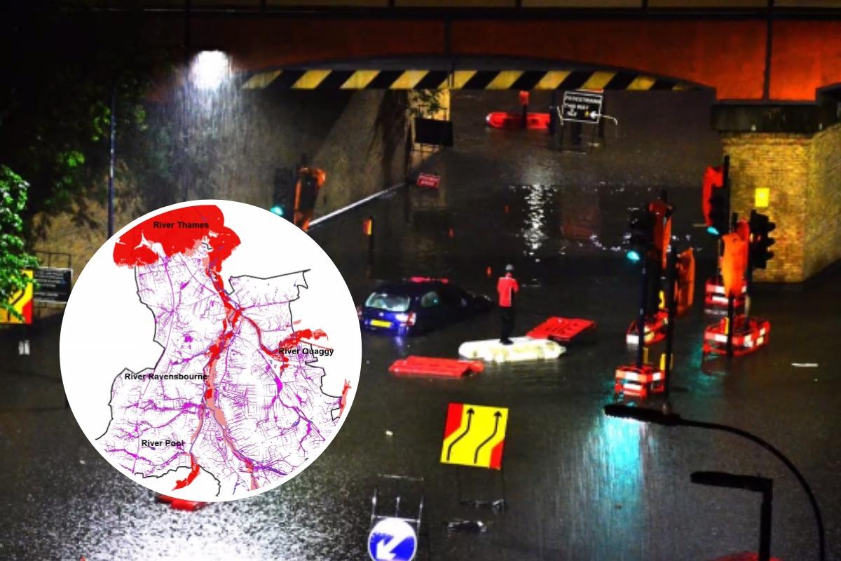
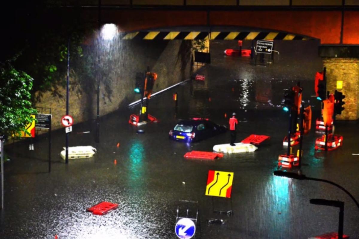
People and properties in Lewisham face considerable risks of flooding amid the frequent flooding events seen in London this year.
That's according to information presented at a virtual meeting on flood risk in Lewisham held over Zoothis week.
The meeting was convened by the legendary Qwag environmental group, a community-led project aimed at river conservation and restoration in the borough.
Lewisham Council's Flood Risk Manager Marcus Gayle was invited by Qwag to discuss the issue in detail and gave an informative take on the risks facing Lewisham residents.
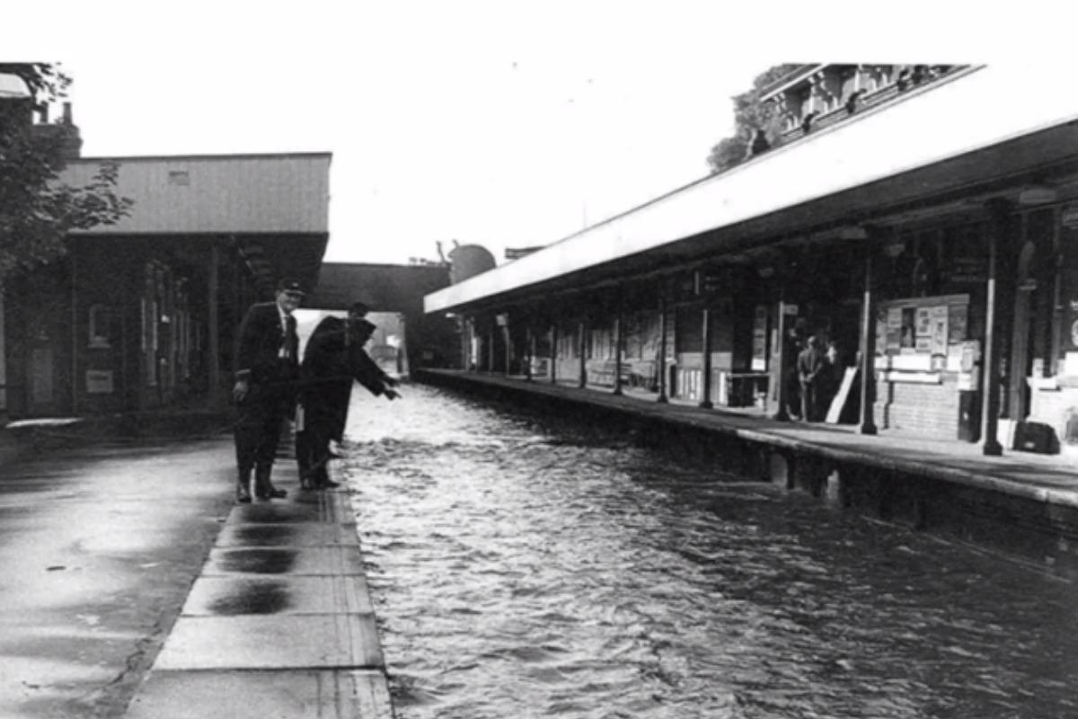
He detailed Lewisham flooding incidents from Catford Station in 1968 to Loampit Vale in 2016, and pointed out how the built-on urban environment is further heightening flood risks by making the ground impermeable and unable to drain heavy rains and surface water sufficiently.

"Due to the urban nature of our cities we have a high amount of impermeable areas that have disconnected the ground from the sub-base and this leads to water flowing over the land," Gayle said.
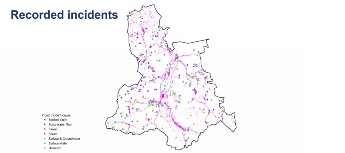
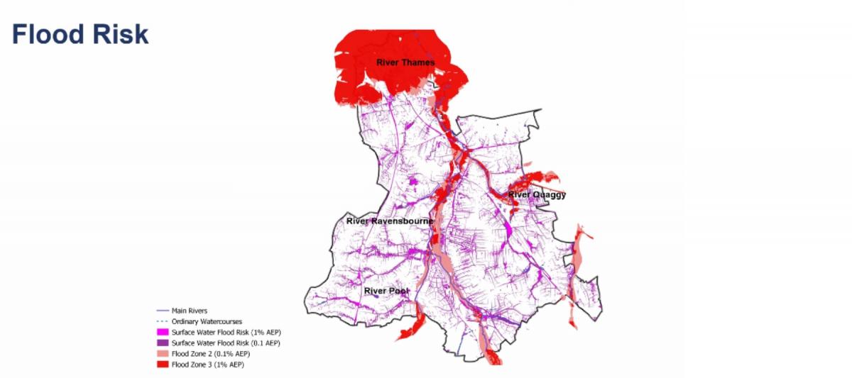
He pointed out that surface water flooding often occurred on pathways close to water courses like the Ravensbourne or Qwaggy because water finds the "path of least resistance".
"The built environment can impact flood risk and although there are flood defences in place these things can fail if they're not maintained and looked after properly they can lead to further flooding," Gayle said.
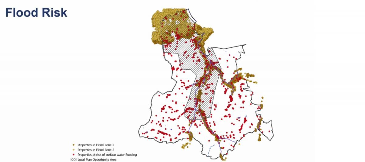
Indeed, one map shown by Gayle during the presentation showed the area designated for Lewisham Council's Local Plan Area of Opportunity, which is likely to host new development projects, that closely matched with the higher risk areas of the borough when it comes to flooding.
"Lewisham has housing targets to meet and the borough is proposing to build those houses in that central area, and many of them are going to be in areas that are close to the river so that's why it's really important to have a catchment-based approach. Those developments need to consider the flood risk upstream," he said.
"A lot of the Ravesbourne River catchment sites for example are outside of Lewisham and that's why organizations like Qwag are so key because rivers don't follow political boundaries and to reduce flood risk and improve the river area and environment we need input from a while catchment and a coordinated response to flood risk from the political to the community and individual levels."
Summer rainfall in the UK will likely become less frequent, but more intense with climate change which could lead to greater risk of flash flooding and a risk of longer dry spells leading to droughts in some regions. pic.twitter.com/Gfw26Jw8IU
— Met Office Business (@MetOfficeB2B) July 20, 2021
As carbon emissions continue to cause Earth to heat up amid the climate crisis, more widespread flooding and heavier rainfall in parts of the world including the UK is expected.
According to the Met Office, the UK’s climate is already becoming wetter and more extreme weather events are happening:
"For example, the highest rainfall totals over a five day period are 4 per cent higher during the most recent decade (2008-2017) compared to 1961-1990.
"Furthermore, the amount of rain from extremely wet days has increased by 17 per cent when comparing the same time periods," a spokesperson for the authority said previously.


Comments: Our rules
We want our comments to be a lively and valuable part of our community - a place where readers can debate and engage with the most important local issues. The ability to comment on our stories is a privilege, not a right, however, and that privilege may be withdrawn if it is abused or misused.
Please report any comments that break our rules.
Read the rules here